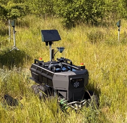
MOBILE SURVEY PLATFORM01—03

FOREST & BIODIVERSITY INTELLIGENCE
Satellites see the canopy. Our autonomous robots measure what is beneath it — every stem, its position and diameter — and turn it into data for forest management and biodiversity monitoring.
From space robotics to the future of forests
 Partner in SPACE-FORESTEuropean Space Agency · ESA Kick-Start
01 / A NEW VIEW OF THE FOREST
Satellites and drones give the overview. We get close to the stems and the forest floor — where the detail on structure and life is found.
LiDAR and cameras map the forest structure. AI detects every stem and estimates its position and diameter at breast height — a basis for inventories and further analysis.
FIELD-TESTED IN SPACE-FORESTWe are linking airborne environmental DNA with the forest's 3D data, so biodiversity can be compared across sites and over time.
eDNA · IN VALIDATIONA data platform ties every measurement to place and time, with clear results and export to the GIS and systems you already use.
BUILT WITH PILOT PARTNERS02 / FROM FIELD TO INSIGHT
Real data from our SPACE-FOREST field trials: raw scans, 3D maps, detected trees and planned survey routes.
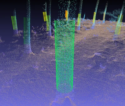 LiDAR / TREE DETECTION
Stems are found in the point cloud. Their geometry gives diameter at breast height (DBH), tied to a position.
Accuracy depends on forest conditions and data coverage.
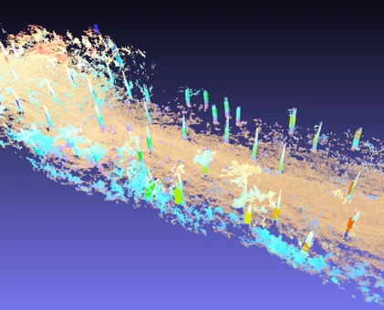 LiDAR / 3D RECONSTRUCTION
The robot scans along its route. The scans are merged into a 3D model of stems, terrain and vegetation — seen from the forest floor.
Colours visualise measurement data.
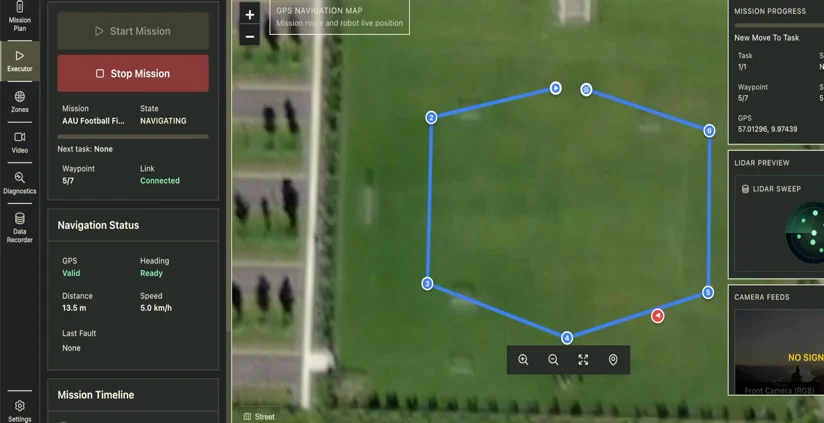 TESS DRIVE / SURVEY ROUTES
A survey area becomes routes and waypoints. The robot follows them under operator supervision and collects data on the way.
Existing interface, now being extended with forest data together with pilot partners.
 COMING NEXT
03 / BIODIVERSITY WITH eDNA
What can DNA in the air tell us about life in the forest?
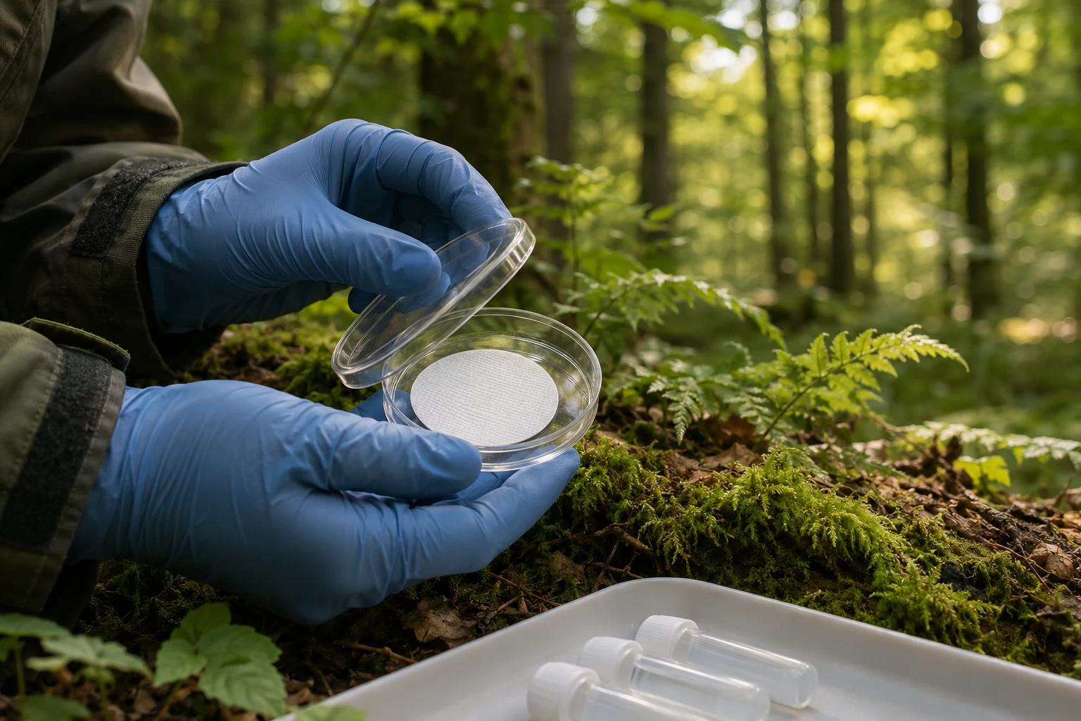
Environmental DNA (eDNA) is the genetic trace organisms leave in their surroundings. A mobile robot can draw air through filters and link the species found in the lab to the structure of the forest.
The goal: systematic biodiversity monitoring — and earlier detection of invasive species.
Validation underway. Results are checked against control samples before launch as a service.
04 / THE FOUNDATION IS LAID
Tess Forest grew out of SPACE-FOREST, an ESA-funded Kick-Start project. There we demonstrated autonomous driving in forest, 3D reconstruction and the first automatic tree measurements.
We also tested mobile insect monitoring with a specialised sensor. That experience now drives Tess Forest.
Read about SPACE-FOREST at ESAEUROPEAN SPACE AGENCY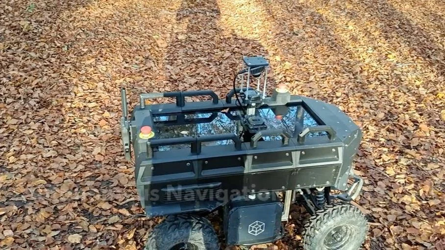
05 / FROM AREA TO DATA
We are looking for forest owners, managers and research partners for the next phase. Together we scope a pilot around one concrete measurement need.
Start a pilotWe agree on area, measurement need and the results that matter to you.
We plan routes and collect data with the robot and an operator.
We process the data and assess quality against the pilot's goals.
You get results in an agreed format that fits your existing tools.
LET'S TALK ABOUT YOUR FOREST
Have an area, a data need or an idea for a partnership? Tell us briefly, and we will get back to you.
Or write to forest@tess-space.comAalborg, Denmark